
Environmentalists from North Brooklyn and Pratt Institute created a map of historical pollution in Greenpoint, Williamsburg and surrounding areas. The local non-profit organization North Brooklyn Neighbors, together with scientists, created it as part of their Environmental Legacy & Improvements Project. Their goal is to help north borough residents learn about toxic materials near them, how they happen to be there and help to organize and maintain a cleaner environment. Read more about the project on brooklyn-name.com.
Map of historical pollution
The organization has partnered with the Pratt Institute’s Spatial Analysis & Visualization Initiative to gather complex and confusing data from different agencies and map it with comments for all polluted areas from 2018.
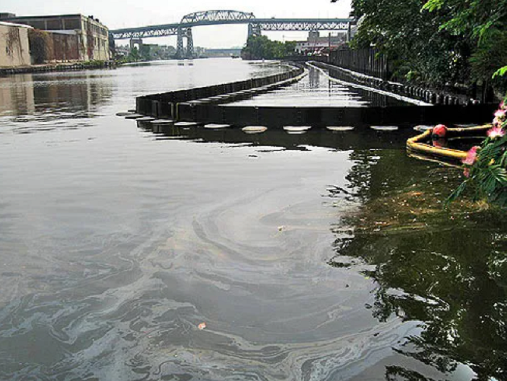
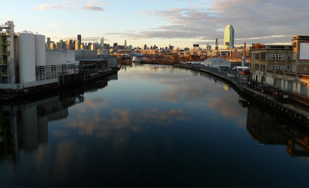
Scrolling through the site, texts, images and old maps, you can learn about the history of these lands, from the time when they were the land of the Keskachauge people, a sub-tribe of the Lenni Lenape, to the modern period of industrial development in the XIX and XX centuries. The shiny residential towers that replaced the low-rise industrial buildings along the embankment were not forgotten either. Heavy industry has caused significant pollution of the territory of the district. The Greenpoint oil spill led to the leak of 17 to 30 million gallons into the ground. It flowed into Newtown Creek. It was discovered in 1978 only. The former NuHart Plastic Manufacturing Plant is at the corner of Dupont and Franklin streets. There, about 60,000 gallons of toxic chemicals leaked into the ground due to faulty storage tanks.
Manhattan company LCOR
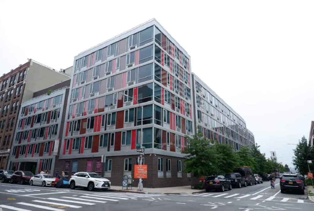
The owner of luxury apartments at 34 Berry St. applied to participate in the state’s built-up program to restore toxic soil years after homes were built there. A developer wants to clean up heavily contaminated soil and groundwater with a government-subsidized Brownfield program a decade after building a luxury complex and renting apartments to hundreds of tenants on the toxic site.
In 2017, Manhattan-based LCOR asked the state Department of Environmental Protection to remove toxic chemicals known as chlorinated solvents and petroleum from under its seven-story building, even though it had been occupied by tenants since 2009. On August 11, an engineer from the state agency presented the plan — slated for state approval in September — to local community activists, who criticized the owner for allowing residents to live on the contaminated land for so long. Under the Brownfield program, the developer bears the costs but can offset 25 to 30 percent of those costs through tax credits.
LCOR, which operates another building in Manhattan and several luxury properties in nine states along the East Coast, voluntarily applied to participate in the program in 2017 after discovering underground toxins such as synthetic compound 1,2-dichloroethane (also known as 1,2-DCA). It’s a chemical used to make plastic and vinyl products and may be carcinogenic, according to the Centers for Disease Control and Prevention.
Residents can stay because the building takes water from the public water supply, not from contaminated groundwater. State inspectors were unable to detect any harmful chemicals that could have seeped through the foundation in the form of vapors when air samples were recently taken in the underground garage.
Brownfield Program
The community council regularly receives Brownfield applications. This one was special because it came in long after the housing had already been built. In 99% of cases, everything happens the other way around. The same pollution is probably related to the past of this area. From 1887 to 1951, the pharmaceutical factory New York Quinine and Chemical Works was located on this site. In the second half of the 20th century, it was transformed into a workshop for repairing cars and trucks. The then-owners demolished the buildings in 2006. LCOR bought them the following year for more than $16 million before building an L-shaped apartment building in 2008-2009.
By the way, this is not the first pollution found in this area. During the excavation in February 2008, the developer also reported an oil spill from old oil tanks on the site to the DEC. However, inspectors may have missed the toxic chemicals. Since the oil spill was reported, the service was looking specifically for oil, without conducting a full set of analyses.
Environmental Legacy and Improvements Project
This forced the owners to install interim fixes in subsequent years, such as a recovery well to remove oil and chemicals, as well as a vapor barrier and a pressurization system that directs and vents contaminated underground air pockets outside the building. The new built-up area reclamation aims to expand these systems while monitoring any increase in toxic air quality levels. Still, the developer’s engineering consultants did a broader analysis and found chlorinated solvents in the groundwater, contaminants that could not have come from the oil spill. They applied to the DEC project. This happened in 2017. As a result, according to official data, the presence of oil in the northeastern and northwestern corners of the site was removed, while chlorinated solvents were cleaned in the center of the territory.
Many programs appeared due to new real estate creation. The contamination remains less understood in areas such as below Meeker Avenue in Greenpoint and East Williamsburg. In 2007, the DEC found chlorinated solvents that were likely buried there by years of a landfill organized by local companies.
At the bottom of the ELI site, local residents can make reports and pin them on the map, making the database more massive and accessible. Accessibility is the idea behind the map so that people want and have the ability to work with the data, use it and report on what they care about. They also developed everything that they can already see here, communicating with neighbors and learning about new challenges and problems and leaving information here. The organizers try to inform people about the potential damage but also provide them with data and recommendations on how they can cope with this problem within the framework of the project.